The Disaster Mapper Decision Support System (GIS)
About This Project
Overview
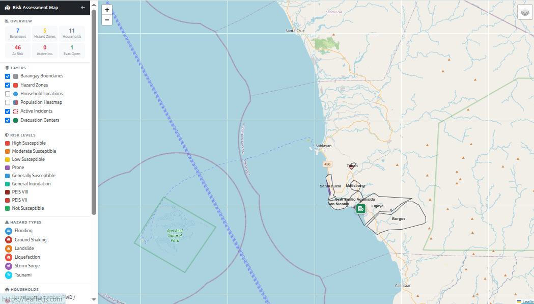
The Disaster Mapper Decision Support System (GIS) is a web-based Geographic Information System (GIS) prototype for the municipality of Sablayan, Occidental Mindoro, Philippines. It helps the Municipal Disaster Risk Reduction and Management Office (MDRRMO) track households, hazard zones, incidents, and population data across all 22 barangays using map-driven data entry and automated spatial analysis.